The surveyors of our world
A journey through history
Did you know that surveyors have been indispensable to the development of the world since civilization began? John F. Brock takes us on a brief journey through the history of surveying.
In today’s data-driven society, in which location-based services have become an omnipresent part of everyday life, there is no doubt that surveying is all around us. But did you also know that surveyors have been indispensable to the development of the world since civilization began? In this brief journey through history, John F. Brock provides a surprising and entertaining look at the importance of surveying through the ages, from ancient times up to the modern day.
It is not difficult to conjure up an image of how people in ancient civilizations may have divided up their lands. They certainly occupied holdings of tenure from the earliest period that the hunter-gatherer nomads decided to settle down at a permanent site, with the domestication of animals and construction of residences. In terms of the written word, the concept of boundaries is well established in the first book of The Bible (Genesis); when Adam and Eve are cast out through the gates of the Garden of Eden after eating the wrong apple, this can be seen as being indicative of a fixed line of demarcation. Even God himself engages in some survey activity when it is stated in the Book of Proverbs (8:27): “When he prepared the Heavens I was there; when he set a compass upon the face of the depth.”
Scribe surveyors
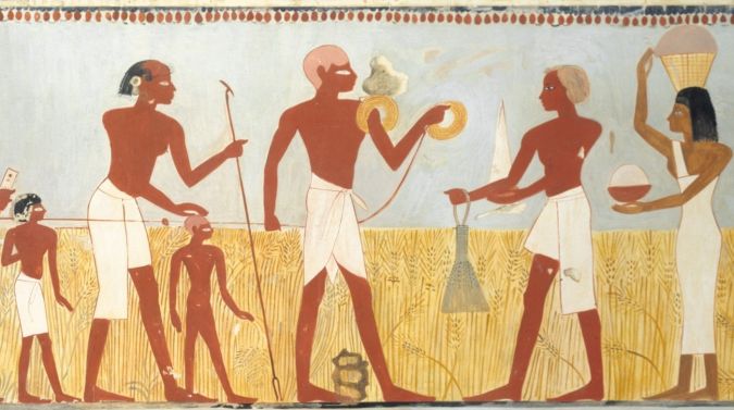
Well before historical records began, the Druids set out the first stages of Stonehenge in a radial pattern (sometime around 3100 BC). The famous stones were actually placed about 2600 BC, which just so happens to coincide with the erection of the only surviving example of the Seven Wonders of the Ancient World: the Great Pyramid of Giza. These giant dedicatory monuments were brilliantly surveyed and orientated to True North within a few arc minutes by the legendary ‘scribe surveyors’ of this prolific civilization, whose surveying duties were widespread. Textual evidence of their work dates as far back as a stone tablet from 3050 BC, which mentions the ‘Stretching of the Cord’ ceremony during the foundation ritual of any construction. The cord in question was the sacred measuring rope used by the surveyors, divided into 100 cubits. It is depicted in two superb ancient statues of two scribes holding the cord in their lap and winding it into the ram’s head of Amun cache. The scribe surveyors were kept busy reinstating boundary stones after inundations, measuring and calculating crop yields for taxation and setting out all of the capital works undertaken by a host of pharaohs who depended upon their ‘Surveying Administration’ to manage the affairs of the Royal Estate and supervise the needs of ever-expanding dominion. One pharaoh of the New Kingdom (around 1360 BC) known as Akhenaten even had his surveyors mark out the perimeter of his new city in Southern Egypt with spectacularly inscribed boundary stones. Many of the rock inscriptions, which are known as the Boundary Stelae of Akhenaten, can still be seen today.
Boundary stones
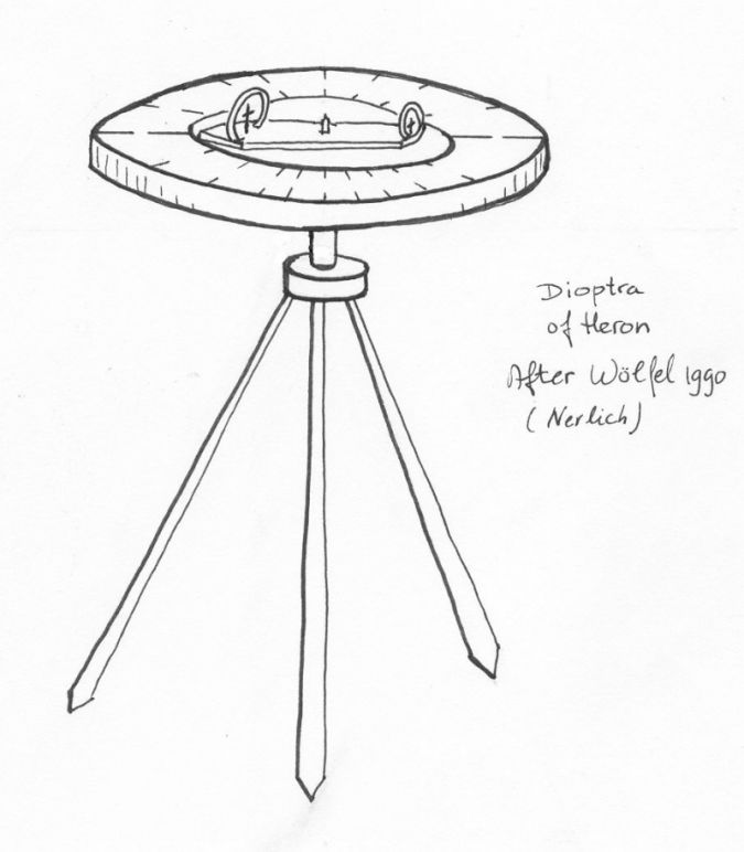
Surveying information has always been passed down to future generations. For example, two of Ancient Greece’s noted philosophers/mathematicians, Thales and Pythagoras, travelled to Egypt to learn about the renowned practical applications of numbers for field surveying. This gave these two revered scholars the framework for the theorems which later came to bear their names. While researching the history of surveying in both Ancient Egypt and Ancient Greece, I came across a man called Hero (or Heron) of Alexandria. He was clearly a Greek surveyor of eminence who was credited with making many amazing inventions such as the syphon and valve. But more notable, from my perspective, was his treatise on a surveying instrument: the dioptra. In his detailed description, the instrument bears striking similarities to the modern-day theodolite, albeit lacking optical enhancement. I have ascertained that he lived between 10 and 70 AD. I was puzzled by the absence of boundary stones in Greek surveying, especially since they were so prolific in the two cultures on either side chronologically (the Egyptians and the Romans). On my most recent trip to Greece in 2015, however, I discovered an inscribed boundary stone from the Ancient Agora near The Parthenon in Athens dating from 550 BC. I was delighted at this find, which marked the start of a real connection between the three revered ancient civilizations.
Right angles
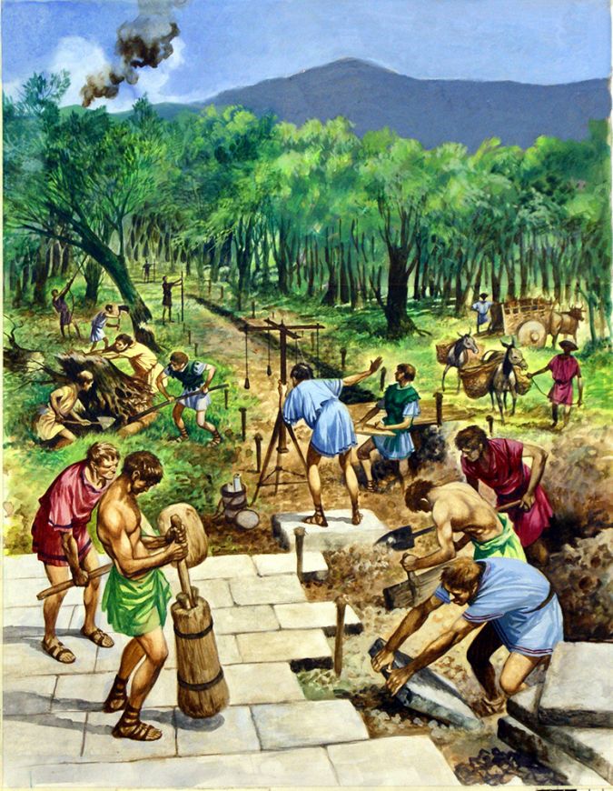
Within the hierarchical structure of Ancient Rome, surveyors were esteemed and highly regarded. Some of their highly precise levelling work is still evident in the many aqueducts, roads and edifices which grace the landscape today. They were responsible for marking out new cities and allotments for landholders as well as being called upon to resolve boundary disputes, both in the field and in court. Roman towns were always laid down in a grid pattern. This pattern originated from Egyptian town plans and had been modified by the Greeks, and the Roman surveying instrument called the ‘groma’ was the perfect tool to achieve 90-degree intersections.
The orthogonal street configuration is clearly visible in the unearthed archaeological site of Pompeii. There, it is also possible to identify a workshop which was run by a surveyor called Verus just before the site was buried by lava from Mt. Vesuvius in 79 AD. The surveyor’s name was found on premises, along with the base and upper metal pieces of a groma together with metal marking spikes, drawing equipment and a portable sundial on a box used to transport writing implements which would have been utilized to determine time and orientation. Another Pompeiian surveyor named Popidius has been identified from his headstone, which bears a relief of a groma on it.
In a solid demonstration of the essential contribution of Roman surveyors, they were entrusted with the duty of marking out international border lines separating the Roman Empire from its adjoining foreign neighbours. Roman legions consisted of about 5,000 men, including an elite group known as ‘The Immunes’ comprising 200 specialists in architecture, building, stone masonry, engineering and surveying. Within that group was a team of ten surveyors called a ‘metator’. We know that three legions were responsible for constructing and surveying Hadrian’s Wall and subsequently Antonine Wall along the northern extremities of the western Roman colony of Britannia: the II, VI and XX legions. This meant that within the legions responsible for these projects there were just 30 surveyors available for any survey work required. A remarkable discovery has since been made along the Antonine Wall between Glasgow and Edinburgh: 19 distance slabs carved in stone by the surveyors to commemorate each section of the wall they erected, dating approximately from 138-142 AD. Each dedicatory stone bears Emperor Antoninus’s name along with the name of the legion and the length of wall completed, some of which are accurate to the nearest half a Roman pace (i.e. five Roman feet).
Gunter’s chain
Following on from the end of the Roman period (in about 460 AD), surveying continued to be performed by responsible professionals – throughout the Dark Ages and beyond the Magna Carta in 1215 on behalf of King John, during the time of the Sheriff of Nottingham. In fact, I even recall seeing an episode of the black-and-white TV series Robin Hood in which the king’s surveyors take measurements using a knotted rope with surprising historical authenticity.
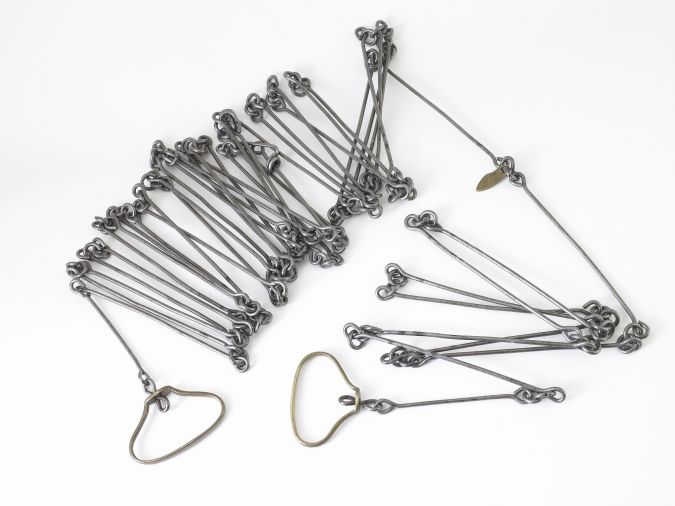
It was not until Professor Edmund Gunter from Gresham College in London University invented his Gunter’s chain (around 1620) that a metallic measuring implement became available to boundary surveyors. This rather cumbersome device consisted of a metal chain of 100 links (each link measured 0.66 English foot, i.e. 20.12cm). This was eventually superseded in the 1880s by long rolls of crinoline wire – rolled up in a canvas casing for ease of transportation, unwrapping and re-rolling – were used to ascertain distances of up to 330 feet (approx. 100 metres).
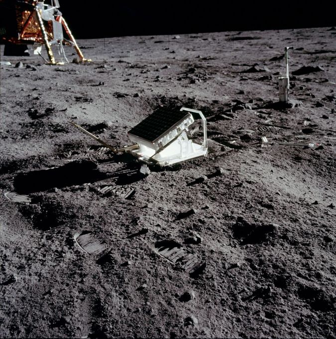
When electronic distance meters were invented in the 1950s, such tape measures became obsolete for long distances; now, surveyors are able to make long-range measurements that are accurate to within a couple of millimetres. In conjunction with the 50th anniversary of the landing of the first man on the moon in 1969, I have recently been researching the Apollo Lunar Surface Experiments Package (ALSEP). This project has always interested me, ever since I learnt that ‘Buzz’ Aldrin placed a bank of retroreflectors on the moon’s surface in the Sea of Tranquility. They have been used to continuously measure distances for the past 50 years, currently mainly from two Earth observatories (one in Fort Davis, Texas, USA, and the other in Nice, France). Thanks to super-powerful Lunar Laser Rangers, the distance between the Earth and the moon is now known with an accuracy of less than one centimetre!
Famous historical surveyors
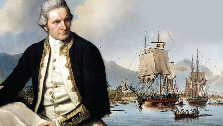
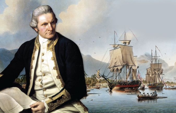
In more recent history, a plethora of monuments or natural features have been built or named in tribute to surveyors. One particularly fine example is the naming of the world’s tallest mountain in honour of Indian surveyor-general Sir George Everest. Numerous rivers, mountains and other features now bear the name of James Cook, who was first trained as a land surveyor in Newfoundland under Samuel Holland and other great Canadian surveyors. And James Cook himself was clearly proud of being a surveyor, since he quite deliberately wrote the word in copperplate font on his brilliantly executed maps.
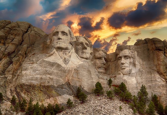
Gutzon Borglum carved the heads of four US presidents into the Black Hills of South Dakota on Mt. Rushmore between 1930-39. Three of those men had previously been surveyors – George Washington became district surveyor for Culpeper County at age 17, Thomas Jefferson was district surveyor for Albermarle, and Abraham Lincoln was deputy district surveyor of Sangemon County in Illinois.
Hollywood
I particularly enjoy trawling through Hollywood movies to spot representations of surveyors, and there are actually many examples. Surveyors have been played by great actors including Randolph Scott (Carson City and Heritage of the Desert), John Wayne (The Fighting Kentuckian), James Mason (Journey to the Centre of the Earth), Brad Pitt (Seven Years in Tibet), Hugh Grant (The Englishman That Went Up a Hill But Came Down a Mountain), Daniel Day-Lewis (There Will Be Blood) and Nicole Kidman (Queen of the Desert). Surveying has even featured in TV series: from MacGyver making a ‘theodolite’ from two sticks, a pair of earrings and some gaffer tape and Peter Graves also using a theodolite to keep track of a suspect vehicle in Mission Impossible, to Jennifer Garner pretending to be a surveyor in a stakeout to catch baddies in an episode of Alias (complete with a designer red hard hat!).
Conclusion
Clearly, surveyors are not only everywhere, but have also been indispensable to the evolution of civilized societies throughout history. And although day-to-day surveying activities may be changing as modern technology continues to advance, the role of surveyors is set to become even more important in the geospatial world of the future.

Value staying current with geomatics?
Stay on the map with our expertly curated newsletters.
We provide educational insights, industry updates, and inspiring stories to help you learn, grow, and reach your full potential in your field. Don't miss out - subscribe today and ensure you're always informed, educated, and inspired.
Choose your newsletter(s)


