Open Data Challenge hackathon supports implementation of geodata in Central Asia
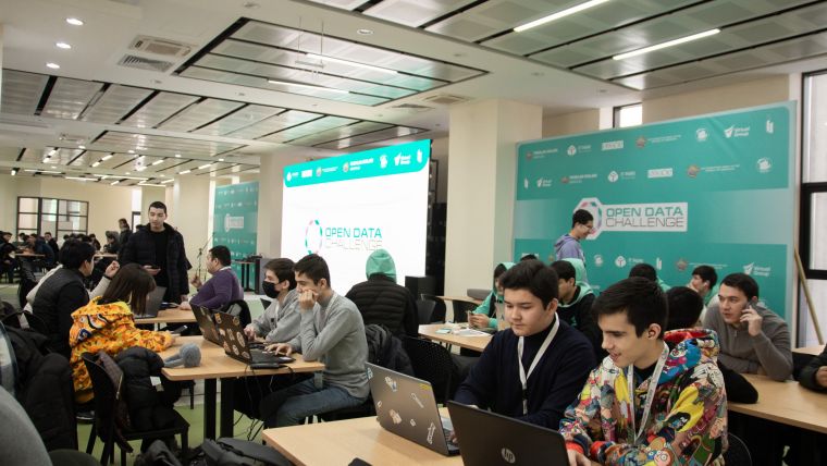
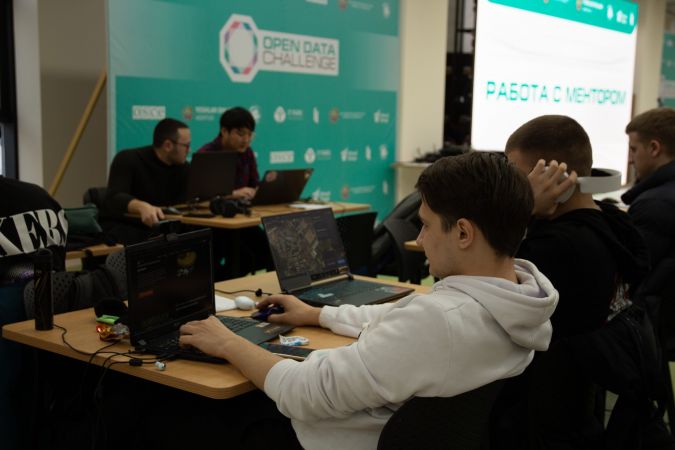
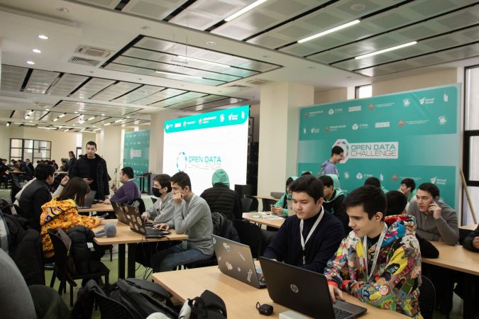
During the Open Data Challenge hackathon held in Tashkent, the capital of Uzbekistan, more than 200 students, divided into 50 teams, spent three days using geodata to tackle the country's most relevant issues. The event was organized from 27-29 January 2023 by Uzbekistan IT-Park, Akfa University, the Organization for Security and Co-operation in Europe, the State Anticorruption Agency and the Statistics Agency, with the mentorship support of commercial and state enterprises.
The key topic of the annual event is open data and its implementation, and the hackathon was once again aimed at stimulating the development of open data applications. Open geospatial data approaches are becoming increasingly important on the path to digitalization and smart management worldwide, and Central Asia is no exception. The region extends from the Caspian Sea in the west to the border of western China in the east, comprising the countries of Kazakhstan, Kyrgyz Republic, Tajikistan, Turkmenistan and Uzbekistan. Historically, Central Asia serves as a bridge between Europe and the Far East, and is known for the legendary Silk Road. The area is now highly dependent on the agricultural sector. However, its inland position means that the region is cut off from the maritime world trade routes. Moreover, the geographical conditions and features such as rivers, mountains and deserts mean that the Central Asian countries are extremely susceptible to the influences of climate change.
Digitalizing to face challenges
To face the various climate-related and socioeconomic challenges, Central Asian countries are actively looking towards digitalization, new educational approaches, startup support, community development and data openness. For example, the government of Uzbekistan recognizes an urgent need to improve its interaction with citizens and the private sector, to take strides to modernize its management system, and to make access to geodata open to all. In 2015, the country adopted an electronic governance law, and parliament considered a law to support the establishment of a national spatial data infrastructure (NSDI). Since then, Uzbekistan has taken a step forward by developing the National Geoinformation System, creating a digital twin of Tashkent, and implementing artificial intelligence (AI) technologies for remote sensing data processing.
Prolific user of geospatial solutions
The Geospatial Readiness Index 2019 describes the Central Asian region as the most prolific user of geospatial solutions, yet geoinformation technology is still weakly adoptable there. Therefore, the main goals of this year’s hackathon were the development of the professional community in the subject area, the development of the relevant competencies of representatives of state and municipal authorities as well as participants, and the realization of the social and economic potential of state and municipal open data. Almost one out of three hackathon projects were inspired by geospatial data. A variety of courageous ideas and unconventional approaches covered a range of themes, from geomarketing to agricultural apps. To support the participants, the company GeoAlert – one of the event partners – launched a new archive containing the links to the open geospatial datasets for Uzbekistan.
In fact, the winning project was powered by geodata and GIS. The winner – the Dzeench team – created a mobile application that requested data from the local cadastral system and compared it with information extracted on the fly from satellite imagery by using AI processing. The application provides not only unrecorded objects but also identifies illegal construction sites. During the award ceremony, a representative of the State Anticorruption Agency highlighted that land rights, cadastral registration and construction monitoring are among the most painful and complex issues in Uzbekistan. Easy-to-use GIS applications and regularly updated remote sensing data are a great way to solve this problem. The winner will further develop the application under the mentorship and support of the GeoAlert team.
Special focus on geospatial data
The path to open data is hampered by restrictions on maps and even VHR satellite imagery, but open sources of geospatial data are now starting to be formed in Central Asian countries. As this unstoppable process of data sharing continues, there are hopes that the next hackathon will include a special section related to geodata.

Value staying current with geomatics?
Stay on the map with our expertly curated newsletters.
We provide educational insights, industry updates, and inspiring stories to help you learn, grow, and reach your full potential in your field. Don't miss out - subscribe today and ensure you're always informed, educated, and inspired.
Choose your newsletter(s)


